Isla Espiritu Santo——Grand Canyon in the Sea

1.9.2013 15:00pm 75F

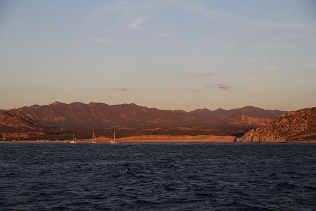
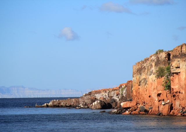
So far, we have cruised for 4 days in south Sea of Cortez. The desert-like Baja mountains kept amazing us with her unique landscape and rustic nature. But today, as Gray Matter approached the infamous Isla Espiritu Santo, we were stunned — the real beauty of the Sea has just begun. Red rock mountains rise and fall, stretching the 8 miles along the N-S axis of the island, with short ridges extending westwards. These short ridges drop sharply into the water, forming the most wild-looking red cliffs. As many described before, it feels like the Grand Canyon, but only in water.

We anchored at Puerto Ballena, one of the three coves in the mid island. Turquoise water occupied the inner half of the cove, ending in white sandy beaches. A tranquil paradise.

Red cliffs surround the cove, with Baja Peninsula in the distance.

Continue reading

Bahia Los Frailes

1.9.2013 15:00pm 76F

Sea of Cortez is notorious for northerly winds in the winter. We just had our first taste in the last week. Four out of five days, strong wind blew out of the north, stirring up big swells, making northbound passage into Sea of Cortez very challenging. It is not comfortable but still doable in a trawler or powerboat, really a pain for those sailboats trying to sail up wind in deep swells.

We anchored at Bahia Los Frailes. Beautiful anchorage and very well sheltered from N wind and swell. We stayed there for 3 days to wait out these N winds.

Continue reading

First fishing expedition

1.4.2013 15:00pm 76F

When we bought N6206, previously “Feeling”, we inherited a bunch of fishing gear with the boat. With little to none fishing experience, we kinda just left them as they were. Luckily, two weeks before we left San Francisco, Erik, our neighbor at West Point, helped us sorted out our fishing gear and gave us a few lessons on fishing. Knowing just enough to be dangerous, we rigged up two fishing poles, gearing up for our first fishing expedition on the way to Cabo.

It was one of the most beautiful days on this trip, blue sky and flat sea. We set the lines and just hung out in the aft pilothouse cockpit. Fishing or not, we had a blast watching all the sea life out there, dolphins, sea lions, whales.

Continue reading

Charlotte B

1.2.2013 15:00pm 70F

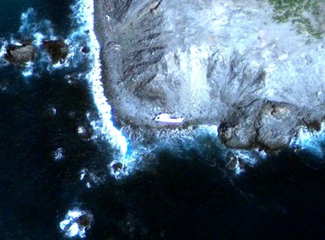
Once we decided to go to Mexico, one of my primary “tourist” attractions was the N62 that went on the rocks near Mag Bay April of 2006. We had spoken to James Lieshman who has been aboard about a year later and said most everything was intact. Besides a “Dreamer’s curiosity” – I had a few things I’d prefer not to buy from Nordhavn, like a new door handle for the side door, and a missing scupper door – that with the starboard following sea can sound like a sonic boom while napping the the master cabin.

From the image on Google earth (24° 27.444’N 111° 54.535’W) – you can see she’s laying on her side – so with the sat photo and coordinates we were ready.

Continue reading

18 days / 1000 nm

We crossed 1000 nm since our departure from San Francisco; 1/8 th of our 8000 mile journey is completed in just the first 18 days. We’ve consistly averaged over 8.5 knots / slightly more than 200 miles over 24 hours. In 18 days, we’ve spent 1 day at the dock in Ensenada, we’re very pleased with the battery consumption and power generation.

We’re gaining confidence in picking our weather windows. Between the KVH V7 and our Telcel USB connection here in Mexico, we can download current grib files and NOAA marine forecasts. We deoarted San Francisco ahead of the series of fronts coming out of the North Pacific, road out a gale at anchor in the Channel Islands (definitely have our anchor tackle figured out – not to mention the anchor alarm and GPS track feature). We ran south from Redondo Beach ahead of another front although we had the 10 – 12 foot swells on our Ensenada passage. Now 500 miles south of Ensenada we still have a some NW swell and as forecasted a NE wind which is making things a little sloppy. Last two overnights have had plenty of moonlight – nice to have the horizon in sight.

Continue reading

Isla Cedros

12.30.2012. 13:00 PST 66F

Originally, we planned to stop at Turtle Bay after Ensenada. Tomas recommended Isla Cedros instead. We were skeptical, as the anchorage looks fairly exposed on the chart, but decided to check it out.

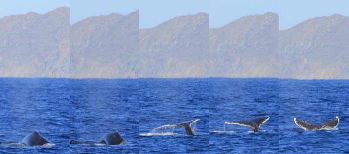
It is about 240 NM from Ensenada to Isla Cedros. Most of the trip was gorgeous — blue sky and following sea — Gray Matter averaged 8.9 knots the whole trip. We spotted several humpback whales on the way — they are HUGE.

whale Continue reading

Ensenada – first taste of Mexico

2012.12.29. 7:23 PST 65F
We had a very positive experience at Ensenada. Based on other cruiser’s recommendation, we planned our stay the Cruiseport marina. The staffs here are very professional, not only process the majority of paper works for custom clearance, immigration etc, also drove us to the immigration office and assisted the entire immigration procedure. It took us about 2 hours to get everything done, much faster than we had expected. After that, we got a ride to the TelCel, MX mobile carrier, to get a prepaid sim card and 3G data plan. Cruiseport even arranged an English-speaking lady to help us at Telcel.
Marina office
Marina office
Continue reading

Redondo Beach — Ensenada

Redondo Beach was our last stop in the US. We anchored at King’s harbor — no guest slip here was big enough to accommodate Gray Matter. Harbor patrols here are also the fire department, observing an impressive 24/7 schedule even during Christmas — very professional and friendly staffs. After doing some shopping and catching up with friends and family. we left at noon today for Ensenada, Mexico. We plan to run overnight and arrive Ensenada tomorrow morning.

We anticipated rough seas as small craft advisory was on.  It turned out to be no drama. We do have some big swells rolling from NW, but GrayMatter handles them no problem. It is going to be a nice ride to Mexico.

Dinghy fully-loaded with grocery

Continue reading